
Enroll Today for $50 Off Drone Pilot Ground School
(Now Through July 31st)
Become an FAA-certified drone pilot with Drone Pilot Ground School, an online test prep and training course for commercial drone pilots looking to pass the FAA Aeronautical Knowledge Test for a Remote Pilot Certificate.
Over 99% of our nearly 20,000 students have passed the FAA’s exam on their first attempt.
Enroll in Training for $299 $249
Use code ENROLL50 for $50 off and get instant access to our self-paced test prep course.
What’s Included?
Enroll in Training for $299 $249
Use code ENROLL50 for $50 off and get instant access to our self-paced test prep course.

Inside a Typical Lesson
People learn and absorb information differently. That’s why most of our lessons allow you to:
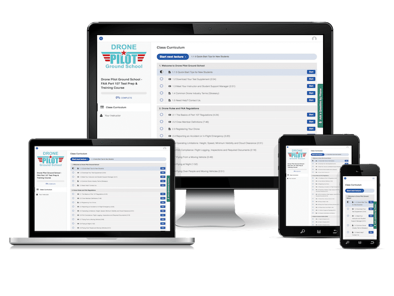
Full Curriculum
Welcome to Drone Pilot Ground School
(Now Through July 31st)
Become an FAA-certified drone pilot with Drone Pilot Ground School, an online test prep and training course for commercial drone pilots looking to pass the FAA Aeronautical Knowledge Test for a Remote Pilot Certificate.
Over 99% of our nearly 20,000 students have passed the FAA’s exam on their first attempt.
Enroll in Training for $299 $249
Use code ENROLL50 for $50 off and get instant access to our self-paced test prep course.
What’s Included?
- Everything you need to pass the test. Our course covers all 120+ knowledge concepts across 65+ video-based lessons that the FAA requires drone pilots to learn in the UAS Airman Certification Standards
- Bonus lessons with practical flight knowledge. Our flight proficiency lesson demonstrates flight sequences for the beginning sUAS operator. You also get a pre-flight checklist and guides on how to conduct airspace research and how to apply for airspace authorization and waivers.
- Plus, bonus lesson on business operations. Learn from a drone lawyer and other industry professionals about how they approach important legal, marketing, insurance and business considerations.
- 350+ practice questions and answer key. We provide test questions for you to practice on, every step of the way. Take the quiz at the end of each lecture, plus our 5 full-length practice tests.
- 12-page cram sheet. Key takeaways from each of our lessons to help you study more effectively.
- 1:1 customer support. Get support from our Student Support Manager via phone and email when you have questions or experience issues.
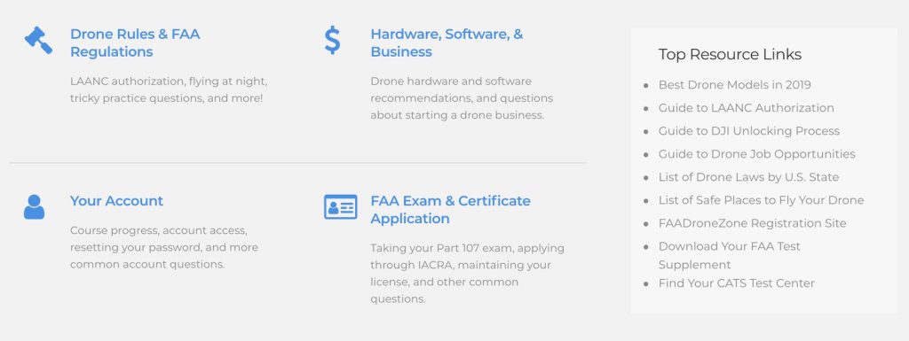
- Learning / Help Center. We’ve rounded up the top questions from past students along with our answers and organized them in a searchable database. This is an additional study resource for you.
Enroll in Training for $299 $249
Use code ENROLL50 for $50 off and get instant access to our self-paced test prep course.
Inside a Typical Lesson
People learn and absorb information differently. That’s why most of our lessons allow you to:
- Watch or listen to the video. Each lesson begins with a dynamic, instructor-led video with illustrations.
- Read the lesson. If you prefer to read, below each video is a detailed text lesson that includes the full video transcript plus additional information and resources.
- Quiz yourself. At the end of each lesson, take a quiz that immediately tests your understanding of the content.
- If you prefer, work offline and take notes. Use our downloadable, printable PDFs to read offline or print out, highlight and mark up as you wish.
- Access 24/7 at home, work or on the go. View the course materials on your desktop, tablet and phone.
Full Curriculum
Welcome to Drone Pilot Ground School
- 5 Quick-Start Tips for New Students
- Download Your Test Supplement
- Meet Your Instructor and Student Support Manager
- Common Drone Industry Terms (Glossary)
- Need Help? Contact Us.
- Browse our Drone Pilot Knowledge Base
- The Basics of Part 107 Regulations
- Crew Member Definitions
- Registering Your Drone
- Reporting an Accident or In-Flight Emergency
- Operating Limitations: Height, Speed, Minimum Visibility and Cloud Clearance
- FAA Compliance: Flight Logging, Inspections and Required Documents
- Flying From a Moving Vehicle
- Flying at Night
- Flying Over People and Moving Vehicles
- Flying Visual Line-of-Sight
- Alcohol, Drugs and Physiology
- Airspace Authorization and Waivers
- Class B Airspace
- Class C Airspace
- Class D Airspace
- Class E Airspace
- Class G Airspace
- Special Use Airspace
- Military Training Routes (MTRs)
- TFRs and NOTAMs
- What’s a Sectional Chart?
- Latitude and Longitude
- VFR Checkpoints
- Notification Boxes
- MSL vs. AGL
- Airports and Radio Frequencies
- Isogonic Lines
- Maximum Elevation Figures
- Victor Airways
- Advanced Sectional Chart Interpretation
- Reading a Chart Supplement
- Runways and Traffic Patterns
- Right of Way
- Towered vs. Untowered Airports
- Standard Conditions and Density Altitude
- Wind and Currents
- Moisture, Fog and Frost
- Reading a METAR Report
- Reading a TAF Report
- Operating in Extreme Weather
- Clouds, Ceilings and Visibility
- Stable vs. Unstable Air (Understanding Air Masses)
- Hazardous Flight Operations
- Emergency Operations
- Lost Link Procedures
- LiPo Batteries
- Aeronautical Decision-Making (ADM)
- Crew Resource Management (CRM)
- PAVE, IMSAFE & DECIDE Models
- 5 Hazardous Attitudes
- Radio Communications
- UAS Loading and Performance
- UAS Maintenance and Inspection
- Pre-Flight Checklist
- 5 Full-Length Practice Tests
- Cram Sheet // Am I Ready to Take the Test?
- Finding Your Test Center
- Test Day Checklist
- Using IACRA to Apply for Your Remote Pilot Certificate
- Flight Proficiency Challenge // Course Diploma
- Recurrent Knowledge Test Prep
- 3 Full-Length Practice Tests (Recurrent Exam)
- Flight Simulator and Basic Proficiency Training
- How to Conduct Airspace Research
- [Guide] Airspace Authorization and Waivers
- [Guide] Drone Liability and Hull Insurance
- [Guide] Pricing Your Drone Services
- [Interview] Using Drones to do Real Estate / Property Marketing
- [Interview] Ask a Drone Lawyer: Key Legal Considerations for Starting a Drone Business